More heavy rain and wind forecast as Sheffield looks set to break May weather record
and live on Freeview channel 276
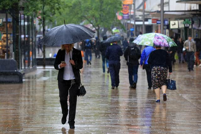
The miserable May weather will continue on Friday with outbreaks of heavy rain and windy conditions forecast; however, this will start to ease off over the weekend as the low-pressure system clears out later on Friday, leaving continued showery remnants for the weekend.
Saturday will likely be the driest day for many, with sunny intervals and intermittent showers at times.
Advertisement
Hide AdAdvertisement
Hide AdMay so far has been cooler and wetter than average – Sheffield’s current monthly rainfall is 114.3mm, but the team at the Weston Park weather station expect that figure to increase in the next few days, overtaking the 2014 total of 121.0mm, making May 2021 the wettest May since 1983.

Despite unsettled conditions continuing through the weekend, there is a sign of drier conditions to come from Tuesday, with some indications of temperatures starting to climb towards more typical figures for the time of year.
Temperatures on Tuesday will reach a maximum of 14 degrees Celcius before increasing again throughout the week, eventually reaching 18 degrees as May draws to a close.
This spell of weather will likely keep nights cooler than the long-term average, but warmer days compared to what we’ve seen recently.
Advertisement
Hide AdAdvertisement
Hide AdChief Meteorologist, Dan Suri said: “There are some glimmers of hope in the forecast into next week, with more settled weather possible from Tuesday. In areas of prolonged sunshine, we should be seeing some quite pleasant conditions, but night temperatures will continue to stay stubbornly low.”
Hour-by-hour forecast for Friday:
6 am – Heavy rain
7 am – Light rain
8 am – Light rain
9 am – Light showers
10 am – Heavy rain
11 am – Light rain
12 pm – Light rain
1 pm – Heavy rain
2 pm – Heavy rain
3 pm – Heavy rain
4 pm – Light rain
5 pm – Light rain
6 pm – Light rain
7 pm – Light rain
8 pm – Light rain
9 pm – Light rain
10 pm – Overcast
11 pm – Cloudy
Met Office forecast in full:
Today:
Quickly turning cloudy as a band of rain pushes in from the west by midday. The rain will be heavy at times, particularly in the west of the region, with strong winds. Maximum temperature 13 °C.
Tonight:
The poor weather will continue overnight, with widespread rain becoming slightly lighter by dawn. Winds will ease for a brief spell overnight, and it will feel milder than previous nights. Minimum temperature 9 °C.
Friday:
Rain to continue across the region in the morning, with a few drier, brighter spells possible during the afternoon, Heavy rain showers returning throughout the evening, turning lighter overnight. Maximum temperature 12 °C.
Outlook for Saturday to Monday:
Sunny for many on Saturday with intermittent showers. Fine on Sunday, but a band of heavy rain and strong winds will sweep eastwards later. Monday showery, strong winds are likely in some areas.